
This self-guided walking tour of Waller Creek, the urban stream and ecosystem that bisects The University of Texas at Austin, was created by Kristin Phillips (Communications Coordinator, Office of Sustainability) and Timothy Riedel (Research Educator, Freshman Research Initiative); Kathryn Gatliff (Student Intern, Office of Sustainability) took the photos.

Before you go:
The tour is about 1.9 miles long and takes about an hour.
Map: please print this PDF if you prefer.
Bus: CapMetro stops are throughout the route and are noted in text.
Parking: Health Center Garage (not hospital garage) on Trinity Street just N of 15th St.
PART 1: Healing Through Prairie in the Health District
This section—a leisurely 20-30 minute walk—focuses on the UT Austin Health District (Dell Medical School Campus, UT Austin School of Nursing, and the Dell Seton Medical Center at The University of Texas).

1. School of Nursing
Map Location
The UT Austin School of Nursing is the major center of nursing education and research in Texas. Nursing courses were first offered on campus in 1960 when faculty members were transferred from The University of Texas Medical Branch at Galveston. Currently, over 80 faculty supervise four degree programs that serve 500 undergraduate and 300 graduate students. In front, thornless mesquite (Prosopis chilensis) is planted to the north and native huisache (Vachellia farnesiana) graces the front with a wildflower garden. This building does not have public access, but the courtyard is furnished with benches and tables crafted by UT carpenters from wood harvested on campus by UT Landscape Services. Look across the street to Little Campus: the Arno Nowotny Building, the second oldest building on campus (1857) that was originally built as the Texas Asylum for the Blind and designed by the same architect (Abner Cook) who built the governor's mansion, the original UT Main building, and other prominent buildings in Austin.
Walk S to cross Red River to the E sidewalk. The oak street trees are growing together: the darker gray pavers mark the boundary of an underground planter.

2. Dell Medical School Campus
Map Location
UT’s new medical school—the first to be built from the ground up at a top-tier research university in nearly 50 years—was designed with sustainability and wellness in mind. Dell Medical School is rethinking the role of academic medicine in improving health—and is doing so with a unique focus on our community. The first class of 50 students graduates in May 2020. All three Dell Med buildings—the Health Learning, Health Transformation and Health Discovery Buildings—are certified LEED Gold. The Health Learning Building plaza contains three transplanted live oaks surrounded by inland sea oats, including two oaks that were moved together because of entwined root systems. The Spiral of the Galaxy sculpture by Marc Quinn is a bronze cast of a conch based on one in the British Natural History Museum collection. The sculpture was acquired by Landmarks, the university’s public art program. Listen to an audio guide. Look across the street to the Dell Seton Medical Center at The University of Texas. Operated by Ascension/Seton, it is the primary teaching hospital for Dell Med and also LEED Gold. The hospital chapel includes repurposed pecan and oak from campus for walls, podium, pews and other elements.
Take a break: Nourish Cafe. Walk S to 15th Street; at the crosswalk; cross Red River and walk downhill past the hospital and past red yucca (which is really hesperaloe and not yucca; note the lack of spines on the tip of the leaves that also have fibrous threads). Stop at bridge over 15th Street and look N.

3. An Urban Creek
Map Location
Looking upstream, you can see a paradigm shift in how UT Austin approaches Waller Creek. The 16-acre Dell Medical School complex embraces the creek; compare this to many buildings north of MLK that wall off the creek. Before the medical school, this area housed the Tennis Center, and Centennial Park; adding the school required moving Red River Street to the east, removing and reengineering much of the soil, and removing 70% of plant material (invasives like bamboo and Arundo donax). The UT Board of Regents requires that the finished floor elevation of all buildings be a minimum level of one foot above the 100-year floodplain. Note that in 2015, the bridge that you are standing on was under water.
Continue W and then turn N for about 10 steps onto path following the W side of the creek

4. Entering a SITES Gold Landscape
Map Location
Note the large transplanted live oak (Quercus virginiana*) that is on the western bank of Waller Creek is permanently held by cables—it is important to the survival of large trees to maintain the original angle and direction to the sun after being moved. To construct the medical school, 12 trees older than a century were transplanted. Nearby, a 50-foot pecan tree (Carya illinoinensis) is rooted.
Do you see prairie or weeds here? The landscape is certified Sustainable SITES GOLD using native plants and reducing the demand on natural resources. The intentional creation of a native ecosystem around the Dell Seton Medical Center is considered beneficial for patient wellbeing and health—as well as the wellness of students, faculty and staff. The SITES rating system was developed by the Wildflower Center with the United States Botanic Garden and the American Society of Landscape Architects beginning in 2006. Note the first of many pocket prairies filled to the west to Trinity Street; some of the live oak were transplanted. The area was seeded with about 25 species of wildflowers and grasses, others were planted.
* For this tour, we use Quercus virginiana for live oaks. But the Central Texas native Escarpment Live Oak, Quercus fusiformis, is also a likely species. The two are impossible to distinguish without DNA.
Continue N along the path until the corner of the garage or start of fencing

5. Rainwater Collection
Map Location
During three-inch rain event, this landscape absorbs 85% of the water on site through the built bioretention ponds that collect water from heavy downpours to slowly percolate into the grounds over 2-3 days. This conserves water by keeping it in the landscape. These ponds also capture and filter (physically and biologically) out the pollution that is concentrated in the “first flush” after a hard rain. If you look up at the parking garage, you can see a 28,000 gallon rainwater collection tank and pumps on the top four floors. This allows for automated deep watering so that plant roots grow deep, and the team waters once a month. In addition to constructed rainwater collection, the plants found in this area—horseherb, inland sea oats, Turks cap, river sedge, Black willow (Salix nigra)—act as a sponge to absorb water. The old foundation in this area is a remnant of an old home seen on the 1887 map (see Stop #34).
Continue to walk about 40 steps N along path and stop near a medium oak

6. Shade Garden
Map Location
As you walk along the path, note that the pavers here are porous, allowing water to seep below. This reduces the amount of impervious cover on campus and helps retain water on site. The shade garden east of the path includes red Turks cap under mature live oaks. On the garage-side of the path is Yapon (Ilex vomitoria), Texas mountain laurel (Sophora secundiflora) and fragrant sumac (Rhus aromatica). Also, note the climbing fig (Ficus pumila) on the building that is not native but can help reduce reflected heat and the heat island effect.
Continue N about 60 steps along path to stop just beyond staircase from garage

7. Wellness Through Nature
Map Location
What is that large block of cement? It allows Landscape Services staff to tie themselves in for safety in this steep ravine. The staff manage one of the largest native landscapes in Austin, and their skill at finding ways to give native plants the edge over invasives without pesticides is in high demand for training other landscapers. Invasives like ragweed return after every storm that rushes through Waller Creek, and birds also spread ligustrum, mulberry and other woody invasives. But health and wellness benefits from more than a beautiful, organic outdoor space; quiet and reflective is also key, and Landscape Services uses electric tools for noise reduction. This equipment is also easier to repair and cheaper to operate, and they also use 85% ethanol in their vehicles. If you look across the creek, there is a heritage live oak by the hospital. This tree was moved 60 feet for construction, but keeping it means that visitors in the cafeteria inside have beautiful green branches to look at. Many staff say that these are the most sought after seats.
Continue N along path to where the patio begins

8. Trinity Plaza: Food and Fire Lanes
Map Location
As you walk into the plaza between the Health Transformation Building (HTB) and the Health Discovery Building (HDB), notice that the pavers are no longer pervious. This is because this part of the landscape needs to hold the weight of fire trucks and other equipment. Plots of native Buffalo grass allow these fire lanes to absorb water. The trees planted in the plaza include desert willow and redbud, and the dark gray pavers under them indicate that they are sunk into a huge planter allowing the trees to share root systems, water resources and nutrients. To identify the ~ 250 tagged trees found along this section of Waller Creek, please look them up by tag number in TreeKeeper maintained by Landscape Services.
Going up: the southern end of the 7th floor of the Health Transformation Building has an 11,000 square foot roof garden planted with spineless prickly pear and red yucca in fiber netting to anchor soil. The Lady Bird Johnson Wildflower Center is researching and developing best practices for roof gardens in central Texas. Roof gardens reduce the urban heat island by reducing energy consumption in a building as well as absorbing rainwater/reducing flash flooding. They even provide habitat for wildlife; researchers are studying the bees in this space. This planting has not been watered since October 2017.
Take a break: Nourish Cafe. Continue N along path and turn to E to middle of bridge

9. Bridge Vista
Map Location
Flash flooding is common in central Texas because of the limestone bedrock and lack of deep soil to absorb water. Here, you can see the engineered channel of Waller Creek that helps slow down the water during storms. During construction, bone fragments were found near here which shut down construction for awhile. It appears that Waller Creek was used as a dump in the past, at least from a butcher shop. Note the fast-growing black willow are in the creekbed; the most common large trees seen along this portion of Waller Creek include pecan (Carya illinoinensis), American elm (Ulmus americana), hackberry (Celtis occidentalis), live oak (Quercus virginiana) and box elder maple (Acer negundo). Within the prairie, native plants that spread and thereby crowd out invasive plants include silver tip bluestem and evening primrose. Look for wildlife. People have seen numerous birds (herons, hawks), racoons and even silver foxes from this spot.
Retrace steps off of bridge and continue N on path until the curved retaining wall on the left

10. Wildflower Prairie
Map Location
The pocket prairie between the path and the creek contains a depression that is a natural bioswale that retains water in the landscape. It is easy to see because the Mexican sycamore (Platanus mexicana) trees planted here require more water than other native trees. In 2016, the prairie was seeded with 25 species and planted with 25 species. Now, botanists have identified over 180 species of native plants. On the west side of the path, purple-flowering Texas sage (Leucophyllum frutescens), Chinquapin oaks (Quercus muhlenbergii), and evergreen Cherokee sedge (Carex cherokeensis) are planted.
Continue N along path to the corner of HDB

11. Pocket Prairie Continues
Map Location
The prairie and native landscape is the first of its kind and size in Austin. Take a moment to identify native bees and other pollinators or learn to watch butterflies. Check out content from the Jha Lab for more information on pollinators. On the building behind (HDB), note the evergreen Texas mountain laurels (Sophora secundiflora) with flowers that 'trip' bees into spreading pollen and the self-attaching hacienda creeper (Parthenocissus sp), a vine related to Virginia creeper and discovered recently in Mexico.
Continue N and then walk to middle of bridge to look N

12. Historic Watson House
Map Location
Looking north from the bridge, the east bank of exposed limestone is interesting, with the 90 degree bend in the river that is also the deepest section of the creek. There is a line in the limestone that makes the east bank with a red oak growing out if it; this may be a fault line. Above the limestone is the oldest building on campus, Watson House. This building was owned by Jim Bowie’s sister-in-law in 1853; there used to be 13 mansions along the bluffs of Waller Creek as well as poorer homes in the floodplain and Swedish immigrants to the east. The iron work was added in the 1920’s by Weigil Ironworks (now Ironworks BBQ downtown). More recently, the house was inhabited by interior designers Arthur P. Watson and Robert Garrett from 1959 to 2007. The house had a party reputation with guests numbering in the hundreds: in L and G Style magazine, Garrett said, “The drinks flowed like a river, so that usually smoothed over any otherwise rough spots for our guests. We were known for Arthur’s Bloody Marys, for the chateau Pink Gins and our lethal Velvet Hammers. Hardly a day passed that we did not entertain friends, clients or other guests for some occasion.” One signature in the guest book was Rock Hudson’s who found shelter from football fans by running up the driveway.
Retrace steps and walk W to Trinity Street. Note the large pecan near a picnic table in pocket prairie. Stop at bridge a few steps up Trinity and before the Trinity Parking Garage.

13. The Forth Bridge
Map Location
The largest live oak moved to make the medical school is just before the bridge over the creek, near Trinity Street. Note the Mexican sycamore (Platanus mexicana). Look for turtles in this part of Waller Creek.
Continue N on Trinity Street's E sidewalk to parking garage

14. Taking Care of Campus
Map Location
Compost and compost tea to keep soil healthy is made in a corner by the Trinity Garage. Landscape Services collects coffee grounds from campus cafes and mixes it with good quality leaves and organic matter. This is brewed with rainwater to make a 'tea' that increases soil health. Other ways that UT takes care of Waller Creek: Environmental Health and Safety hosts Clean Ups twice a year, events that have increased because of student organization. The Dell Medical School/managed native landscape portion of the Waller Creek Walking Tour is finished. Note that as Waller Creek passes under Trinity St. and then Martin Luther King Jr. Blvd. (MLK), it is for a brief time not part of UT Austin; the surface parking area is owned by the state.
Continue up Trinity Street and cross Martin Luther King St. at the light. Walk W along the sidewalk on the N side of MLK to Santa Rita Oil Well plaque.
PART 2: Following the Footsteps of Joseph Jones
A year after Joseph Jones (1908-1999) published his reflective Life on Waller Creek, Walking the Forty Acres: Waller Creek Wilderness Trails and Adjuncts was printed (1983), co-written by with S.P. Ellison and Keith Young. Guiding through "forest primeval with plenteous ongoing geology... nature modified, and... for the most part, technologicobarbarian rubblebumble," the authors suggest that "if you are undertaking this walk during the growing season for poison ivy and ragweed, be advised that both these plants are all too plentiful." Jones was a professor of English for 40 years (1935-1975) and often had his lunch on the western bank near what is now Patton Hall (RLP).

15. Santa Rita Oil
Map Location
The discovery of oil on the University Lands in Reagan County on May 28, 1923 led to the first check of $516.53 to the Permanent University Fund, accelerating the long-term endowment of higher education in Texas. The structure of Santa Rita Oil Well No. 1 was brought to UT in 1940 even though production continued at the Permian Basin site for another 50 years. The trees here are live oaks (Quercus virginiana) and, although not the most common species found near Waller Creek, are typical of campus with a canopy of over 40% oak. The trees on campus are largely because of the efforts of John Calhoun, Comptroller, 11th (Interim) President, and “maker of academic shade.” Before he planted and mapped over 620 oaks (plus other trees), the Forty Acres had a landscape left over from a period of over-grazing and had few trees.
Walk W on sidewalk to bridge over Waller Creek; stop and look N to the San Jacinto Bridge. (Note that if you walk E on MLK, you can see a pollinator garden near the Swim Center)

16. Geology Lesson Between Two Bridges
Map Location
From Ellison, Jones and Young walking tour: Looking north from the MLK bridge to the San Jacinto bridge, “note that the Creek exposes a floor of Austin limestone (Upper Cretaceous, about 75 million years old), on top of which is a lot of stream debris in the form of cobbles, boulders, etc.” If you zoom into campus on the Texas USGS Map, you can see that most of campus is on a layer of 325-420 foot thick layer of Austin Chalk, or the remains of creatures (microfossils) that inhabited an inland sea during the time of dinosaurs. The Chalk, which is under Blackland prairie and the clays of the Taylor Group, is younger than the harder limestone to the west of Austin (the Hill Country) that was exposed between 20-25 million years ago by the Balcones fault zone. Water flows along a fault line to make Waller Creek; note the black willow (Salix nigra), a short-lived tree with fibrous roots that hold soil together.
Continue W on MLK and cross San Jacinto Blvd at the light. Once at the NW corner of MLK & San Jacinto, walk N on path past the Chilling Station #3 and onto Clark Field. Stop where the path connects with track.

17. Clark Field’s Pecan
Map Location
The large, 50-foot tall pecan tree—one of more than 20 on the west bank of Waller Creek at Clark Field—is tagged #4553. All tags can be used to identify and learn about campus trees. Tree #4552 gives UT about $300 in ecobenefits each year. Pecans (Carya illinoinensis) are the State Tree of Texas and native to the Louisiana-Texas-Mexico area. Pecans are one of the most recently domesticated crops and have been widely grown since the 1880's.
Continue N on path between Clark Field and Waller Creek, turning E onto first pedestrian bridge. Stop in middle for view.

18. Bridge Vista No. 1
Map Location
In 2016, UT’s Landscape Services cleared much of the invasive and overgrown plants in Waller Creek; as you walk this urban stream, look for cut 3-inch poison ivy vines and stumps of trees like ligustrum (left in place to hold soil until new plants take root). This alteration opened the canopy, increased visual sight lines, and revealed the system of weirs established for the bald cypress’ (Taxodium distichum) in the 1930s. Weirs and cypress reduce erosion of banks and minimize the need for constructed stability as found in the Dell Medical School portion of Waller Creek. Landscape Services has led several planting of native herbs, wildflowers, grasses and bushes. If you look to the North, can you see the concrete obstacle course from WWII.
Retrace steps back to Clark Field; continue N on path to middle of second, metal pedestrian bridge

19. Bridge Vista No. 2
Map Location
Waller Creek draws from a narrow but completely urban watershed of 3,662 acres that is six miles long. The section that bisects UT is just over one mile and includes 71 bald cypress trees (Taxodium distichum), trees rarely seen on other stretches of the creek. From the bridge, look south on the east bank to a 70 foot tall specimen (tagged 4629) planted in 1936 that provides an estimated yearly eco-benefits of almost $400. Also looking south, the large debris from the Memorial Day Flood in 1981—when thunderstorms dumped more than 10 inches of rain in a few hours—is visible. The Austin area is prone to flash flooding. For example, a flood in 1915 killed 12 people when, according to newspaper, “nearly every house on Waller Creek was flooded or moved by the waters.” In fact, the head of UT Grounds at the time created a fundraiser for a custodian who lost his home at 19th and Waller Creek. South of campus, the city has developed extensive flood mitigation, and Waterloo Greenway is developing a 1.5-mile park system between 15th Street and Lady Bird Lake.
Continue E on bridge to sidewalk along San Jacinto Blvd; walk N along W side of San Jacinto Blvd towards stadium and stop where the sidewalk is built over the E bank.

20. Battle of Waller Creek
Map Location
On October 22, 1969, several hundred students walked up the 21st Street hill from Waller Creek toward the Tower carrying the remains of 39 trees that were felled on the east bank of Waller Creek. Soon, branches and limbs were blocking doorways. This was the final scene of the Battle of Waller Creek which was initiated when UT abruptly announced that San Jacinto Street was shifting west to expand the stadium and add Bellmont Hall. Students obtained a restraining order and sat protectively in trees—some over-night—but Chancellor Frank Erwin ordered police to forcibly remove people (even sawing off one limb with a person still on it) and workers to bulldoze the trees. Twenty seven people were arrested, the first large-scale suppression of a protest on campus. Negotiations with the administration did prevent paving of the creekbed. The impact is still visible: note fewer trees and how the sidewalk cantilevers over the east bank south of 21st Street.
Continue N on sidewalk between Waller Creek and San Jacinto Blvd, crossing 21st St. Just past the bus stop, leave sidewalk and turn a few steps onto the path going N between Waller Creek and the Alumni Center. Take a break: Cypress Bend Café at 21st Street

21. Waller Creek at 21st
Map Location
Fifty years ago, alterations continued on the north side of 21st Street to make way for the stadium expansion. Originally, a channel flowed here from the east side of campus, but it was diverted north toward 23rd Street and the channel took on stadium outflow. The large oaks were saved from removal, making this a lovely shady spot. Look upstream to see if you can spot wildlife; the Waller Creek Working Group is compiling a list of observed species including herons, blotched water-snakes, longear sunfish, red-shouldered hawks, foxes, and raccoons. If you see something, become a citizen scientist and record your observations with iNaturalist.
Near this intersection, an old WWII barrack once stood in the floodplain, one of two buildings that housed the first African American male undergraduates admitted to UT starting in 1956. UT segregated housing until 1964. Check out Dr. Edmund T. Gordon's Racial Geography Tour, an invitation to understand the racial history of campus (tour stop on flags, history and sports).
Continue N on path, walking along the E side of Waller Creek until you see algae along the rock wall that makes up the W side of the creek.

22. Jessen Cascade
Map Location
Looking west to the other side of the creek, remember that this was once pasture for the Horst dairy farm in the 19th century; old cedar fence posts are visible near Morehill Dormitory. A more recent structure is the permanent home for UT’s alumni association, the Etter-Harbin Alumni Center, which opened in 1965 and was expanded in 1990. The “Early Texas” design—a blend of Western and Spanish colonial styles—by architect Fred Day was initially planned to anchor on both sides of Waller with water flowing under the main room. This design proved too expensive and the building sits on the east bank. The Jessen Cascade is the algae-darkened seepage on the west bank that may be the result of a fault line.
Continue N on the path to the coffee shop in the Alumni Center. Take a break: Texpresso Cafe

23. The Living Lab
Map Location
Waller Creek is UT's largest "classroom" and is the site of over 100 years of research and inspiration for faculty, undergrads, graduate students and citizens. While some of that research involves trees and “charismatic megafauna” such as birds, fish, and snakes, there is also research into aspects of the creek not so easily seen with the naked eye. These include bacteria, chemicals, and even diatoms. Chemical research often looks for historic input of pollution such as coal tar from parking lot sealant and lead from old paint. Research by the U.S. Geological Survey (USGS) in Waller Creek was instrumental to making Austin the first jurisdiction in the United States to ban PAH-containing coal tar which has resulted in dropping PAH levels in Lady Bird Lake. Other research has shown that the water in Waller Creek has a chemical and isotopic signature that more closely resembles Austin tap water than spring water. Research on bacteria levels in the creek has consistently found shockingly high levels of E. coli, a known fecal indicator, in most regions of Waller Creek, and for this reason we do not recommend touching the creek water. These E. coli levels have triggered extensive policy changes with how the city and state interact with the creek. State of the art techniques to track chemical and bacterial pollution sources and to describe the overall health of the creek have recently been deployed through the innovative Freshman Research Initiative (FRI) which organizes undergraduate science students into research teams around Urban Ecosystems and Diagnotics. Through the research to better understand Waller Creek, hundreds and eventually thousands of FRI students will develop tools and techniques that will have global impact as urbanization continues in watersheds around the world. Waller Creek is truly a living laboratory that supports the motto “What starts here changes the world.”
Continue N on the path for about 40 steps until easy access to creek is visible.

24. Twin Cypress with Fossils
Map Location
This living classroom drives interdisciplinary research on campus: faculty and students from Civil and Environmental Engineering, Architecture, Natural Sciences, Geological Sciences, and even Art work and collaborate in Waller Creek. Planet Texas 2050 supports projects such as water quality analysis and the core sampling of bald cypress tree rings by the Banner Lab. The idea is to see how riparian systems respond to the progressive failure and leakage of municipal water infrastructure. The results suggest that at some sites along the creek, more than half of the flow is from leaking infrastructure. The tree cores will be used to test the hypothesis that Waller Creek’s trees are more buffered from drought and thus more resilient to climate change than their rural counterparts. Other research tracks nonvenomous blotched water snakes with radio transmitters, allowing Travis LaDuc, Curator of Herpetology, to estimate that there is probably one snake every 30 feet of the creek. The distant past is also visible in Waller Creek: fossilized cephalopods (Protexanites planatus) have been found in the Cretaceous limestones throughout Austin.
Continue N on the path to cypress and statue
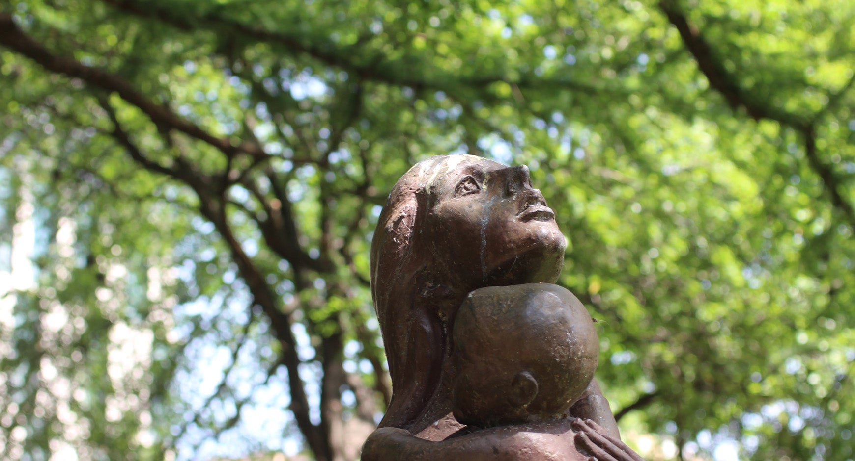
25. Umlauf Sculpture and Cypress
Map Location
Charles Umlauf taught fine art at UT for 40 years, and this bronze mother & child exemplifies his work. Tree 4036, a 65 ft tall bald cypress (Taxodium distichum) was—like many of the cypress on campus—was from Texas' oldest and longest running nurseries near the Guadalupe River area in 1936. The cypress wiers have been important for stabilizing the banks. If you want more information on this tree, check out the Biodiversity Center's feature.
Look across the creek to see the bench memorializing the lunches Joseph Jones had by the “Cretaceous Limestone Gutter”: “Forty years and more I have packed my lunch to Waller Creek. Only since retirement, though, have I felt I had time to spend undertaking small improvements along its rugged banks: ephemeral gestures to be sure, but good for body and spirit alike – an hour or so, three or four days a week, before lunch. Instead of going up the wall I go down to the Creek.” Life On Waller Creek. Out of respect to Jones, Landscape Services left a few specimens that he planted, including English ivy and cast iron plants when removing nonnative plants from the creek.
Explore more by walking N along Waller's W side and check out Dr. Edmund T. Gordon's Racial Geography Tour stop about the Texas Cowboy Pavilion. Or walk up the stairs from the amphitheater and cross Memorial Bridge over Waller Creek. Walk NE on sidewalk around traffic circle.
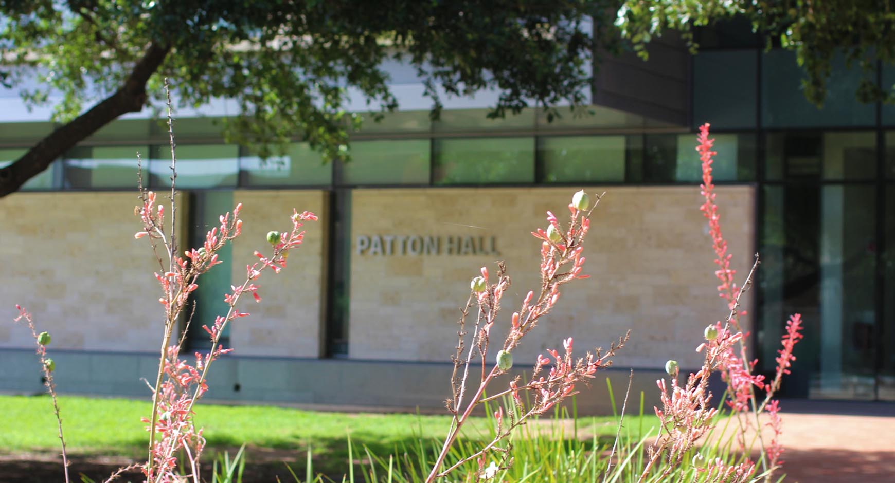
26. Patton Hall (RLP)
Map Location
Waller Creek was originally the eastern frontier of the Forty Acres in 1883. When UT Austin expanded about 100 years ago to include the creek, much of the initial infrastructure focused on moving people over the creek; one of the first bridges, the old stone Memorial Bridge at 23rd Street, was built in conjunction with the stadium in 1924. In 2019, UT's campus reached 3.6 million square feet of LEED-certified buildings (which at the time is 20% of the LEED-certified building in the city), including Patton Hall (RLP) that is LEED-Gold and houses one of the newest of the 156 undergraduate programs: the popular B.A. in Sustainability Studies. As you walk across the traffic circle, note Tree #3985 immediately south of the 23rd Street Bridge. This is the only surviving bald cypress (Taxodium distichum) from the first attempt to plant Waller Creek, the 1928 plants collected from Onion Creek.
Cross 23rd Street and continue N on path between the Winship Building and Waller Creek, stopping before the wide brick bridge

27. Storm Water Management
Map Location
About 95% of the rainwater that hits campus makes its way to a creek either directly or through a storm sewer system. Waller Creek is the largest part of that system since only about 10% of UT's 423 acre main campus drains to other watersheds (the area west of the Tower to Shoal Creek, and the Facilities Complex to Boggy Creek). This means that a one-inch rain event could funnel over 10 million gallons of water to Waller Creek, adding to the rainwater collected in the entire watershed and carrying all surface litter, spills and other remnants of human activity. UT maintains a storm sewer infrastructure that includes 162 culverts or outfalls into Waller Creek. Environmental Health and Safety (EHS) manages the Phase 1 MS4 (Municipal Separate Storm Sewer System) for campus, putting UT on par with large cities in Texas in terms of official reporting on storm water management. A storm water management team coordinates with all campus partners, inspects construction sites, tests water quality, and works to develop systems to slow the flow of rainwater to the creek to reduce erosion and improve the landscape. If you need to report a water quality issue or spill, call EHS during business hours (M-F 8 to 5) at 512-471-3511 or after hours at 911.
Continue N on path to the high, narrow USGS bridge. Cross to middle of bridge.

28. USGS Bridge
Map Location
Two miles upstream from the Colorado River, the USGS built this bridge to measure floods (and literally rise above these events: note this bridge’s height compared to those nearby). Over 2,600 acres of a highly urban landscape with low impervious cover drain to this point. The monitoring station on the east bank—used by the USGS between 1954 and 1980—now helps the Lower Colorado River Authority collect data on rainwater, stream flow and river stage (check out site 248 for current information on this map of monitoring stations). Look down to check out the “measuring stick” running up the slope below the monitoring station. This is a useful tool for seeing historic floods: an 11-inch rain event on May 25, 2015 caused the creek to crest at 9.96 feet, and the highest known measurement of 10.14 feet on November 22, 2004 (we do not have data at this location for the historic Memorial Day Flood in 1981). Also on the east bank but just south of the bridge is a natural sitting area sometimes used for studying, photo sessions and even art installations.
Continue across bridge to E side of Waller Creek; at sidewalk, head N along San Jacinto to end of chain link fence. Look for two cement benches by two oaks in the open grassy area.

29. Urban Ecology in Waller Creek
Map Location
The Texas Palmettos (Sabal mexicana) are volunteers naturalizing north of their historic range. These palms are likely descendants of the old palm planted at Arno Nowotny Building and are thriving in Waller Creek with the aid of a warming climate & the Austin urban heat island. Texas’ flora has included palms for millions of years, and petrified Sabal palmwood is the Texas State Stone. Tree 3947 is a Durand oak (Quercus sinuata), a rare species with a highly fragmented population, it prefers to grow in rich alluvial soils near waterways.
Continue N on San Jacinto, passing bus stop, and cross 24th Street to pollinator garden (between sidewalk and creek)
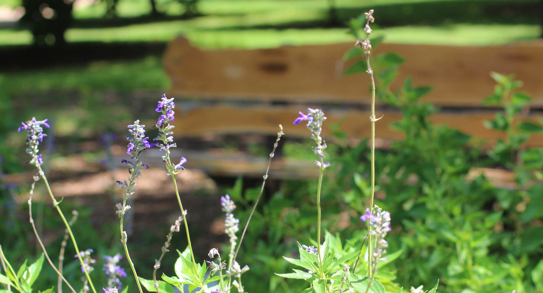
30. Pollinator Garden, Orchard & Benches (same as Green Tour #13)
Map Location
The Orchard, started in 2013, highlights fruit trees that grow well in this region of Texas (peach, plum, Japanese persimmon, fig, and others). A small pollinator garden of native and adapted plants is a new addition, as is a bench made of wood harvested from a campus oak tree made by the Carpenter Shop. Note that the west bank, called the Secret Garden, is a good place to get closer to the water and observe fish. Research over 25 years by the Hendrickson Lab shows that at least five native species that were rare in the 1970's are now gone and a new invasive species from northern Mexico, an aquarium fish known as the Variable Platyfish (Xiphophorus variatus), is now common.
Continue N on Jan Jacinto St. following Waller Creek for about 60-70 steps beyond the area there the path meets the sidewalk in the orchard. Note the Texas Memorial Museum across the street where you can see fossils found in Austin (like a mosasaur from Onion Creek) and learn about Texas biodiversity.

31. Confluence
Map Location
At this point, two tributaries of Waller Creek join together: the Hemphill branch that continues to follow San Jacinto St., and the main branch that crosses under San Jacinto to Creekside Residence Hall. Until 2010, this dorm was named Simkins for a former law professor and Grand Wizard of the KKK. This was UT’s first air-conditioned housing, completed right after the 1954 Brown vs. Board of Education decision that integrated schools. Note that the first African American students were housed in a second WWII barrack that is now the parking garage. Explore more by checking out Dr. Edmund T. Gordon's Racial Geography Tour stop about Creekside.
The main branch continues north past the Michener Center for Writers housed on the other side of Dean Keeton in the J. Frank Dobie house that UT purchased in 1995. Dobie was a folklorist who documented Texan western stories and newspaper writer who saved the Texas longhorn breed from extinction. The main branch continues north and upstream through Eastwoods Neighborhood Park, Lee Elementary School, Hancock Golf Course, Elizabet Ney Museum/ Shipe Park, UT’s Intramural Fields and up to the start near Lamar and Airport.
Continue N on the W side of San Jacinto along the Hemphill (western) tributary of Waller Creek. Stop near the new metal bridge to EER Building.

32: Creek History Written in Two Buildings
Map Location
The bridge over Waller Creek to the LEED Silver Engineering Education and Research (EER) building is a symbol of the new approach to this urban stream: embracing it with doors opening onto the creek. Many of the older buildings on campus—like the Ernest Cockrell Junior (ECJ) building to the north—are more likely to wall off the creek with few doors or windows. The recent adoption of the Waller Creek Framework Plan (2019) is the latest step towards including this urban stream into the greater campus. Also, the cypress trees here are different. Because the trees planted in 1928 and 1936 were not developing knees, fifty additional cypress were collected East Texan bayous in 1950 and planted north of the confluence by faculty member Carl Eckhardt (who also switched the power plant to natural gas).
Continue N along the Hemphill tributary and cross Dean Keeton St. at the light. Continue past bus stop until you see the stone bridge to the Chilling Station

33. Bridge Near Chilling Station
Map Location
There are over 20 bridges over Waller Creek on campus. Some help pedestrians navigate the landscape, like the footpath in Stop #34; others enable the flow of heavy vehicular traffic, like the bridge over Dean Keeton Street. Some bridges also allowed UT to develop the eastern campus since utilities and other infrastructure use bridges for support. The bridge that you are standing on gives access to Chilling Station No 5, one of UT’s five chilling stations that—along with two thermal energy storage tanks that hold 10 million gallons of chilled water—satisfy the cooling requirements for 22 million square feet in more than 160 campus buildings. These are part of UT’s Utilities and Energy Management innovative ways to get more energy out of the natural gas that powers campus, so much so that UT’s carbon emissions are the same as in 1976 despite large growth in population and space.
Walk NE on San Jacinto, following the Hemphill tributary to the pedestrian bridge to a parking lot.

34. The Edge of UT's Main Campus
Map Location
Waller Creek is named for Austin's first mayor, Edwin Waller, who laid out the plans for the city and capitol starting in 1839. The historic map of Austin (including Waller Creek's main tributary) is from 1887, four years after UT Austin opened its doors and one year before the capitol building was completed.
Thank you for walking along Waller Creek with us!
